Every bus stop, taxi rank, rail station, airport and ferry port in Britain. Get the fullscreen version. Zoom in or full details - and be patient. It's got a lot of data to load
Heard of the National Public Transport Data Repository before? Unless you're the ultimate transport enthusiast, there's no reason why you should; hidden behind pre-registration and restrictions on commercial use it was not exactly easy to find.
But all that has changed, thanks to data.gov.uk. The Liberal-Conservative coalition always pledged to release Whitehall's largest databases to the world; this is one of the biggest.
Why's it such a big deal? The official description gives you some idea of how important it is:
A snapshot of every public transport journey in Great Britain for a selected week in October each year. The dataset is compiled with information from many sources, including local public transport information from each of the traveline regions, also coach services from the national coach services database and rail information from the Association of Train Operating Companies
So, for the week of 5-11 October, 2009, every train, coach and bus journey is catalogued and recorded in a huge set of spreadsheets, divided up by every region in the country (excluding Northern Ireland, that is). The official blurb basically says you can't do anything with this data without the use of seriously heavy-duty databases and big old computers.
That's a bit "here's all the data but sod you if you want to actually do anything with it". When, in fact, there's quite a lot you can do with it. On an ordinary computer. Using excel.
We've copped out a bit and simply extracted the full list of every transport stop in the UK (stops.csv in the downloads). That's still some 406,458 records. Using Google Fusion tables, which is better at handling huge datasets than the Google spreadsheets we normally use, we put together the map above (thanks to Rebecca Shapley at Google NY for all her help). It takes a while to load and to get the full detail, you need to zoom in close to places.
Theoretically, you can use the data to map routes and use of the network, with the right tools.
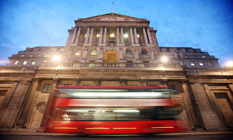 UK transport database: London has one of the lowest rates of bus stops in the country. A bus passes the Bank of England in London. Photograph: Simon Dawson/Bloomberg via Getty Images
But that basic CSV file can tell you other things too. We wanted to know which place in Britain has the least bus stops - and which the most. That would mean finding out the number of stops in each area, comparing populations to the ONS population stats and working out a rate per 100,000 people.
Because this data is compiled by locality rather than local authority (a town centre is a locality, for instance), we needed yet another database to compare it to. And that database is the National Public Transport Gazetteer (NPTG) which is basically a list of every administrative boundary for transport in the UK.
Daithi O'Crualaoich helped put the two together and the result is below. It shows that London has one of the lowest rates for bus stops in the country - perhaps mitigated by extensive tube and overground rail network. At the top end are the Western Isles in Scotland and Gwynedd in Wales, which have low populations but lots of bus stops
But that leaves a wealth of data unexplored in folders of data which detail routes and services. Can you help us?
• DATA: download the full stops data as a Google Fusion table
• DATA: Get the bus stops population data
• Get the full NPTDR data from data.gov.uk
• Search the world's government with our gateway
Development and aid data
• Search the world's global development data with our gateway
Can you do something with this data?
Flickr Please post your visualisations and mash-ups on our Flickr group
• Get the A-Z of data
• More at the Datastore directory
• Follow us on Twitter
Bus stops per 100,000 people
Click heading to sort
|
Admin Code
|
AreaName
|
Region
|
Bus and coach stops
|
Bus stops per 100,000 people
|
|
|
| 20 |
Gwynedd |
W |
1,822 |
1,534 |
| 142 |
Eilean Siar |
S |
394 |
1,504 |
| 114 |
Argyll & Bute |
S |
1,344 |
1,493 |
| 118 |
Dumfries & Galloway |
S |
2,014 |
1,356 |
| 113 |
Angus |
S |
1,425 |
1,292 |
| 135 |
Perth & Kinross |
S |
1,868 |
1,280 |
| 12 |
Carmarthenshire |
W |
2,273 |
1,257 |
| 94 |
Northumberland |
NE |
3,909 |
1,257 |
| 33 |
Monmouthshire |
W |
991 |
1,126 |
| 63 |
Warrington |
NW |
2,200 |
1,112 |
| 24 |
Isle of Anglesey |
W |
764 |
1,110 |
| 25 |
Isle of Wight |
SE |
1,543 |
1,101 |
| 115 |
Scottish Borders |
S |
1,239 |
1,099 |
| 128 |
Highland |
S |
2,358 |
1,069 |
| 13 |
Ceredigion |
W |
801 |
1,048 |
| 97 |
Shropshire |
WM |
3,052 |
1,046 |
| 81 |
Gloucestershire |
SW |
6,140 |
1,042 |
| 126 |
Fife |
S |
3,764 |
1,035 |
| 23 |
Herefordshire |
WM |
1,852 |
1,034 |
| 78 |
County Durham |
NE |
5,232 |
1,033 |
| 134 |
Orkney Islands |
S |
206 |
1,030 |
| 92 |
North Yorkshire |
Y |
6,142 |
1,028 |
| 64 |
West Berkshire |
SE |
1,537 |
1,005 |
| 75 |
Derbyshire |
EM |
7,614 |
1,002 |
| 73 |
Cornwall |
SW |
5,231 |
985 |
| 30 |
Merthyr Tydfil |
W |
543 |
975 |
| 89 |
Lincolnshire |
EM |
6,764 |
969 |
| 108 |
Wiltshire |
SW |
4,289 |
940 |
| 14 |
Conwy |
W |
1,045 |
938 |
| 45 |
Powys |
W |
1,231 |
935 |
| 101 |
Suffolk |
EA |
6,635 |
929 |
| 140 |
Stirling |
S |
819 |
923 |
| 112 |
Aberdeenshire |
S |
2,210 |
908 |
| 130 |
Midlothian |
S |
727 |
900 |
| 77 |
Dorset |
SW |
3,566 |
883 |
| 74 |
Cumbria |
NE |
4,343 |
877 |
| 125 |
Falkirk |
S |
1,314 |
862 |
| 95 |
Nottinghamshire |
EM |
6,587 |
848 |
| 107 |
West Yorkshire |
Y |
18,770 |
843 |
| 67 |
Wrexham |
W |
1,120 |
841 |
| 34 |
Neath Port Talbot |
W |
1,152 |
838 |
| 60 |
Torbay |
SW |
1,089 |
813 |
| 131 |
Moray |
S |
703 |
802 |
| 76 |
Devon |
SW |
5,989 |
801 |
| 98 |
Somerset |
SW |
4,169 |
796 |
| 152 |
Cheshire West & Chester |
NW |
2,546 |
780 |
| 120 |
East Ayrshire |
S |
934 |
777 |
| 19 |
Flintshire |
W |
1,156 |
771 |
| 61 |
Torfaen |
W |
699 |
771 |
| 99 |
South Yorkshire |
Y |
10,145 |
770 |
| 132 |
North Ayrshire |
S |
1,036 |
765 |
| 40 |
Pembrokeshire |
W |
893 |
761 |
| 4 |
Blaenau Gwent |
W |
520 |
758 |
| 91 |
Norfolk |
EA |
6,468 |
758 |
| 137 |
Shetland Islands |
S |
168 |
757 |
| 56 |
Swansea |
W |
1,748 |
756 |
| 122 |
East Lothian |
S |
722 |
746 |
| 138 |
South Ayrshire |
S |
826 |
741 |
| 106 |
West Sussex |
SE |
5,822 |
734 |
| 83 |
Greater Manchester |
NW |
19,067 |
733 |
| 62 |
Vale of Glamorgan |
W |
911 |
731 |
| 1 |
Bath & North East Somerset |
SW |
1,285 |
723 |
| 15 |
Darlington |
NE |
719 |
716 |
| 16 |
Denbighshire |
W |
691 |
715 |
| 22 |
Hartlepool |
NE |
649 |
714 |
| 42 |
Plymouth |
SW |
1,826 |
711 |
| 10 |
Caerphilly |
W |
1,227 |
710 |
| 119 |
Dundee |
S |
1,013 |
706 |
| 55 |
Stoke-on-Trent |
WM |
1,669 |
699 |
| 100 |
Staffordshire |
WM |
5,742 |
693 |
| 58 |
Telford & Wrekin |
WM |
1,119 |
689 |
| 2 |
Blackburn with Darwen |
NW |
950 |
679 |
| 37 |
North Lincolnshire |
EM |
1,093 |
679 |
| 72 |
Cheshire East |
NW |
2,457 |
677 |
| 109 |
Worcestershire |
WM |
3,715 |
668 |
| 96 |
Oxfordshire |
SE |
4,229 |
660 |
| 88 |
Leicestershire |
EM |
4,237 |
657 |
| 87 |
Lancashire |
NW |
7,661 |
657 |
| 104 |
Warwickshire |
WM |
3,504 |
655 |
| 85 |
Hertfordshire |
SE |
7,147 |
652 |
| 41 |
Peterborough |
EM |
1,110 |
648 |
| 116 |
Clackmannanshire |
S |
327 |
648 |
| 48 |
Rhondda Cynon Taff |
W |
1,517 |
647 |
| 111 |
Aberdeen |
S |
1,381 |
646 |
| 47 |
Redcar & Cleveland |
NE |
875 |
636 |
| 69 |
Bedford |
SE |
1,004 |
635 |
| 129 |
Inverclyde |
S |
508 |
633 |
| 70 |
Buckinghamshire |
SE |
3,129 |
633 |
| 84 |
Hampshire |
SW |
8,116 |
629 |
| 93 |
Northamptonshire |
EM |
4,289 |
627 |
| 43 |
Poole |
SW |
875 |
620 |
| 39 |
Nottingham |
EM |
1,855 |
617 |
| 7 |
Bridgend |
W |
827 |
616 |
| 38 |
North Somerset |
SW |
1,274 |
609 |
| 103 |
Tyne & Wear |
NE |
6,730 |
608 |
| 151 |
Central Bedfordshire |
SE |
1,527 |
604 |
| 51 |
South Gloucestershire |
SW |
1,581 |
603 |
| 127 |
Glasgow |
S |
3,534 |
601 |
| 17 |
Derby |
EM |
1,464 |
600 |
| 79 |
East Sussex |
SE |
3,059 |
597 |
| 68 |
York |
Y |
1,182 |
595 |
| 49 |
Rutland |
EM |
227 |
591 |
| 102 |
Surrey |
SE |
6,579 |
591 |
| 3 |
Blackpool |
NW |
824 |
589 |
| 136 |
Renfrewshire |
S |
993 |
584 |
| 54 |
Stockton-on-Tees |
NE |
1,100 |
576 |
| 71 |
Cambridgeshire |
EA |
3,440 |
567 |
| 80 |
Essex |
SE |
7,916 |
566 |
| 35 |
Newport |
W |
786 |
560 |
| 66 |
Wokingham |
SE |
906 |
560 |
| 21 |
Halton |
NW |
659 |
555 |
| 90 |
Merseyside |
NW |
7,410 |
549 |
| 57 |
Swindon |
SW |
1,090 |
548 |
| 32 |
Milton Keynes |
SE |
1,297 |
548 |
| 11 |
Cardiff |
W |
1,840 |
547 |
| 5 |
Bournemouth |
SW |
894 |
542 |
| 141 |
West Lothian |
S |
927 |
542 |
| 26 |
Kingston upon Hull |
Y |
1,383 |
527 |
| 65 |
Windsor & Maidenhead |
SE |
757 |
526 |
| 124 |
Edinburgh |
S |
2,510 |
525 |
| 36 |
North East Lincolnshire |
EM |
798 |
508 |
| 133 |
North Lanarkshire |
S |
1,654 |
507 |
| 86 |
Kent |
SE |
7,152 |
507 |
| 139 |
South Lanarkshire |
S |
1,564 |
503 |
| 18 |
East Riding of Yorkshire |
Y |
1,683 |
499 |
| 27 |
Leicester |
EM |
1,515 |
497 |
| 8 |
Brighton & Hove |
SE |
1,270 |
496 |
| 31 |
Middlesbrough |
NE |
667 |
475 |
| 53 |
Southend-on-Sea |
SE |
777 |
473 |
| 121 |
East Dunbartonshire |
S |
492 |
470 |
| 123 |
East Renfrewshire |
S |
418 |
469 |
| 28 |
Luton |
SE |
900 |
463 |
| 46 |
Reading |
SE |
701 |
462 |
| 117 |
West Dunbartonshire |
S |
400 |
440 |
| 52 |
Southampton |
SW |
945 |
399 |
| 9 |
Bristol |
SW |
1,721 |
397 |
| 6 |
Bracknell Forest |
SE |
455 |
395 |
| 29 |
Medway |
SE |
1,003 |
394 |
| 59 |
Thurrock |
SE |
592 |
377 |
| 50 |
Slough |
SE |
452 |
352 |
| 44 |
Portsmouth |
SW |
634 |
312 |
| 82 |
Greater London |
L |
24,122 |
311 |
| 105 |
West Midlands |
WM |
14,362 |
264 |

 UK transport database: London has one of the lowest rates of bus stops in the country. A bus passes the Bank of England in London. Photograph: Simon Dawson/Bloomberg via Getty Images